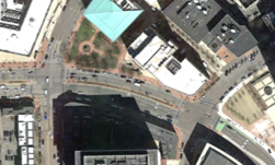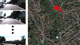
Researchers from the Toyota Technological Institute at Chicago (TTIC) and Carnegie Mellon University developed a deep learning-based method that locates a ground vehicle by using satellite imagery as the only prior knowledge of the environment.
Knowing the exact location of a vehicle is critical for autonomous cars, and currently GPS systems are being used which the researchers claim suffer from limited precision and are sensitive to multipath effects – such as in “urban canyons” formed by tall buildings.
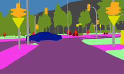
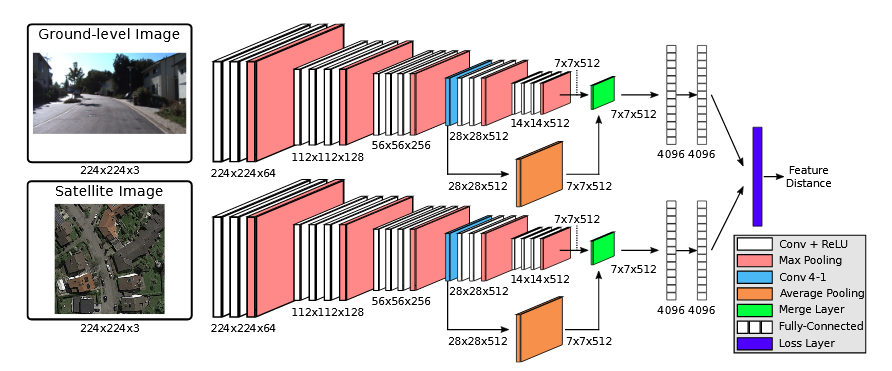
Using TITAN X GPUs, CUDA, and Keras with the Theano deep learning framework, the researchers multi-view neural network learns to match ground-level images with their corresponding satellite view. For training, they used ground-level images from the KITTI dataset collected from a moving vehicle and paired them with the matching satellite image.
The next step for the work is to adapt their model so it is able to tolerate more severe appearance variations like seasonal changes.
Read more >
Related resources
- GTC session: Open-World Segmentation and Tracking in 3D
- GTC session: How Cities and DOTs can Implement Road Safety Technology
- GTC session: Reward Fine-Tuning for Faster and More Accurate Unsupervised Object Discovery
- Webinar: Using GPUs to Accelerate HD Mapping and Location-Based Services
- Webinar: Exploring Efficient Tools for Autonomous Vehicle Development and Tuning
- Webinar: Transforming Warehouse Operation Management Using Computer Vision and Digital Twins